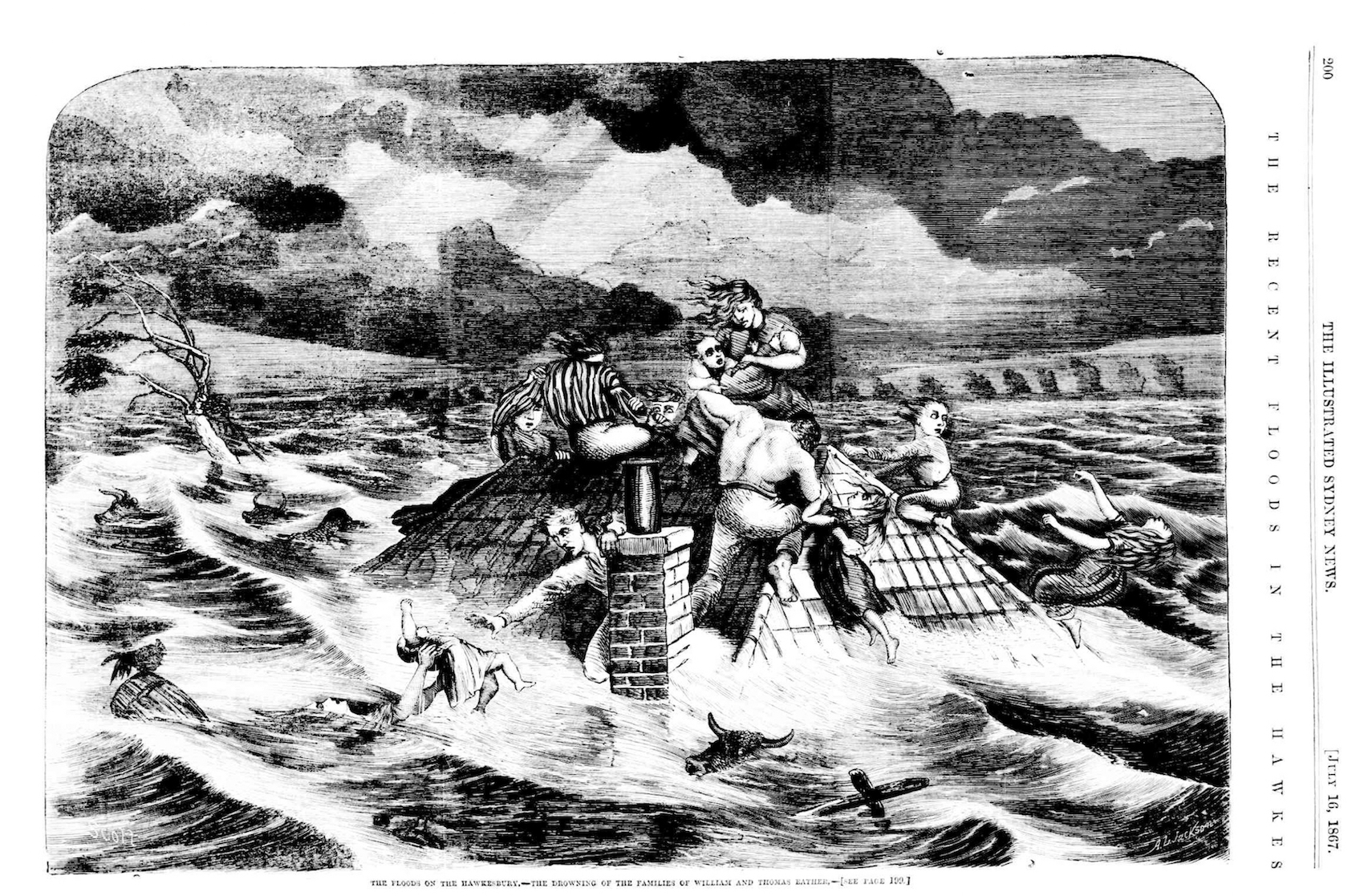
The Eather family, 1867 Hawkesbury floods, Illustrated Sydney News, 16 July 1867, National Library of Australia via Trove
Wild weather just hit Sydney and parts of Australia’s east coast, causing four deaths and an estimated $38 million in damage. It seems each time this occurs, photographs and film footage captured by awestruck residents dominate the news, and this sort of media frenzy has happened throughout Sydney’s history. I spoke with Jamie on 2SER Breakfast about Sydney’s stormy past.
According to Dictionary of Sydney contributor, Sharyn Cullis, there is evidence of severe weather hitting the New South Wales east coast in the past 10,000 years. Since European settlement, there have been various instances of natural disasters hitting Sydney and surrounds.
The people of the Hawkesbury River area thought they had seen the worst of it in 1864, when the river peaked at 14.6 metres causing widespread damage with many families left destitute. But in June 1867, disaster struck again when heavy rain and winds caused the water to rise to 19.2 metres destroying homes and buildings from Pitt Town to Wisemans Ferry. The 12 deaths caused by this flood came from the one family. The deaths of the Eather family were dramatically depicted in the Illustrated Sydney News in July 1867.

Sydney suburbs flooded, 8 June 1889, Australian Town and Country Journal via Dictionary of Sydney
The low-lying inner west suburbs of Sydney were struck by heavy rains in May 1889. Residents in suburbs including Croydon Park, Canterbury and Marrickville were illustrated in the newspapers in rowboats rescuing the homeless and rowing through the streets past partially submerged shopfronts and homes. One Newcastle newspaper reported that 150 residents had been ‘rescued’ and were given provisions at the Royal Exchange Hotel on Marrickville Road. The Australian Town and Country Journal also published a series of dramatic images, from a bus crash on the Cooks River bridge in Canterbury, to a Manly ferry fighting choppy seas and a baker wading through water to deliver bread in Marrickville!
Other floods have occurred along the Georges River, which flows from the O’Hares Creek catchment 80 kilometres north and east to meet Botany Bay at Taren Point. The February 1873 flood was the biggest rising to 10.3 metres at Liverpool. Eighty-three years later, the 1956 flood caused five deaths, with 1,000 homes flooded and 8,000 people evacuated. Homes in Bankstown, Panania, East Hills, Milperra, Moorebank and others were inundated and residents were rescued by police and army ‘ducks’ as well as by civilians in row boats, some had been waiting for assistance on their roof-tops.
Floods would occur in the years that followed with one in 1988 overwhelming 1,000 homes along the Georges River, in Cabramatta and Prospect Creek. Sharyn Cullis notes, trends over time show that floods can ‘cluster in a small number of years, not to be experienced for decades, and reappear’. So between 1901 and 1940 there were only two large floods on the Georges River, but between 1969 and 1979 there were six.
Storms have long been a part of life in Sydney and its floodplain areas, and there will be plenty more in the years to come. Flood management and planning will no doubt play a role as government bodies and emergency services grapple with the challenge of wild weather and its impact on the community.
Listen to my segment at 2SER radio. For other interesting segments, see my Dictionary of Sydney project post and visit the Dictionary of Sydney blog.
It is good to keep this conversation going, there is nothing new about the furious impacts of Austalia’s unpredictable weather, and climate change impacts can be exacerbating this. I especially like hearing about flooding in the inner west.